Bueno, la idea era escribir un poco durante el invierno sobre esquí de travesía en Bariloche, pero (como siempre) no tuve tiempo. Así que mejor escribo todo junto, algo así como un resumen del invierno pasado.
Well, the idea was to make some
blog post during the winter about skiing around Bariloche, but (as
usual) I didn't have the time. So I thought about putting it all
together in one post, something like a summary of this past winter.
 |
| Buscando un poco de nieve, cerca del cerro Bella Vista. Searching for some snow, near Bella Vista hill. |
A veces es un poco molesto lo corto que se me hace el invierno acá por Bariloche, ¿o será que realmente es corto? De cualquier manera, este año tuvimos algo de cuatro meses de nieve, desde principios de junio hasta mitad de octubre (en realidad, hasta mitad de noviembre, pero en octubre estuve de viaje así que no pude esquiar mucho durante la primavera).
El invierno fue un tanto "caluroso": Tormentas de nieve seguidas de días cálidos, mezclado con alguna que otra tormenta de lluvia, así que no hubo mucha nieve en polvo por acá... De cualquier forma, cualquier nieve es mejor que ninguna, así que mejor ir a esquiar en lugar de quejarse por el clima...
La parte mala del invierno "caluroso" es que la nieve estuvo casi siempre arriba de 1200 m, con lo cual ir a esquiar casi siempre incluía un poco de caminata, salvo que tomes la silla en Catedral o algún otro centro de esquí de por acá cerca. Al final, pude esquiar más días que el invierno anterior. También tomé un par de cursos de avalanchas para aprender un poco más sobre esto de moverse en la montaña en invierno, el manto de nieve, etc.
Para cerrar la temporada, fuimos al cerro Tronador con El Pájaro y Manque. Tuvimos el privilegio de llegar a la cumbre (que era nuestro objetivo), e incluso pudimos disfrutar la bajada a través de nieve primavera y un poco de nieve volada, desde el filo entre los glaciares Blanco y Manso hasta el refugio Meiling. La bajada desde el refugio hasta el auto no estuvo tan fácil, entre la nieve húmeda y las catorce horas de esquí y caminata, nos llevó otras cuatro horas para llegar a la base
A continuación hay algunas fotos de esta temporada, gracias a mis compañeros de esquí que me permitieron disfrutar de mi adicción al esquí de travesía :P Las fotos incluyen la fecha y el lugar, así no me olvido por donde anduve. Nos vemos la temporada que viene en la huella de subida, o quizás en alguna otra parte de la montaña.
Sometimes it's really annoying how short the winter feels here in Bariloche, or it is really short? Nevertheless, this year we had about four month of snow, from early June to mid of October (in fact, more like mid of november, but in october I had to travel so I didn't ski too much during spring ).
This past winter was rather "hot": Some snow storms followed by warm days, mixed with some raining, so not too much powder here... After all, any snow is better than none, so better go skiing than complain about weather...
The downside of this "warm" winter is that the snow line was almost always above 1200 m, so there was almost always some walking involved, unless you take the lifts in Catedral or other nearby ski center. In the end, I could get more skiing days than the previous winter, so thats' good. I also took a couple of avalanche courses to learn about winter travel, the snowpack, etc.
As the closing trip of the season, I went to Cerro
Tronador, with El Pajaro and Manque. We had the privilege of stepping in the summit (which was our goal) and we even enjoy some good skiing, across some wind crust and good spring snow, from the ridge between Blanco and Manso glaciers to Otto Meiling hut. Getting from the hut back to the car wasn't so easy, the heavy spring snow summed up with the fourteen hours of skinning, skiing and walking, so the final way down took us about four hours.
Following are some pictures of this past winter, thanks to my ski partners who allowed me to enjoy my addiction to backcountry skiing :-P In the pictures I included the place and date for each picture, as a reminder of where I've skied. See you next season in the skin track, or maybe elsewhere in the mountains.
 |
| 15 de junio: Matías y Ana bajando por Condro II. Dando vueltas por Catedral, antes de que empiece la temporada. No había mucha nieve todavía, pero pudimos disfrutar de algunas bajadas por nieve en polvo sin pisar. June 15th: Matías and Ana going down through Condor II piste. Some early turns in Catedral, before the season stars. Not so much snow yet, but we enjoy some powder turns in ungroomed pistes. |
 |
| 20 de junio: Un poco de nieve primavera a fin del otoño, Ana subiendo el cerro Lopez. Estaba tan caluroso que me olvide que casi estábamos en invierno. June 20th: Some spring conditions at end of autumn, Ana skinning up Lopez hill. It was so warm that I forgot it was almost winter. |
 |
| 20 de Junio: Bajando del cerro Lopez, cuando nos alcanzó la sombra a las cinco de la tarde me acordé que casi estábamos en invierno. Las nubes bajas en le valle muestran un poco de inversión térmica. June 20th: Getting down from Lopez hill, I realized it was almost winter when the shadow hit us at 5:00 pm. The clouds in the valley show some thermal inversion |
 |
| 21 de junio: Ana buscando un poco de esquí en el cerro Huemul, cerca de El Bolsón. Estuvimos dos días de tormenta en el refugio Piltriquitrón, sin embargo pudimos esquiar un poco entre la lluvia, nieve y algo de luz plana. June 21th: Ana is going for some skiing in Huemul hill, near El Bolson. We spend two stormy days in Piltriquitrón hut, nevertheless we enjoy some turns between rain, snow and flat-light. |
 |
| 5 de julio:Día de entrenamiento en Catedral, increíblemente esta pista todavía estaba sin pisar después de la última nevada un par de días antes. July 5th: Training day in Catedral, surprisingly this piste was still untracked after the storm two days before. |
 |
| 9 de julio: Condiciones climáticas variables cerca del refugio del Lopez, estuvimos tentados en subir más arriba del refugio, pero ahí el terreno es complejo, así que optamos por esquiar un poco entre el bosque. Este día estaba raro, el viento soplaba del este, cuando en general viene del oeste o nor oeste. July 9th: Variable conditions near Lopez hut, we were tempted to go past the tree line, but the terrain there is rather complex, so we decided to go skiing in the forest. This day was rare, the wind was blowing from the east, where it normally does it from the west or north west. |
 |
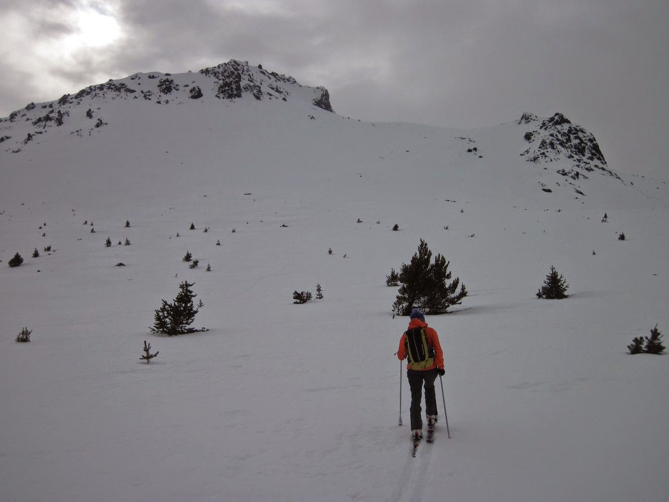
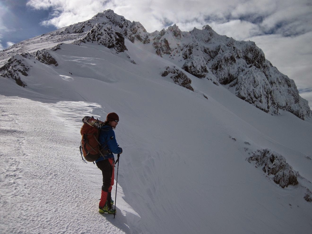
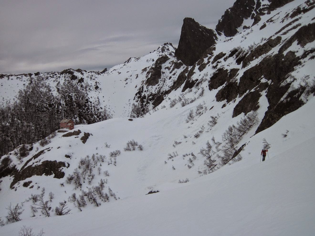
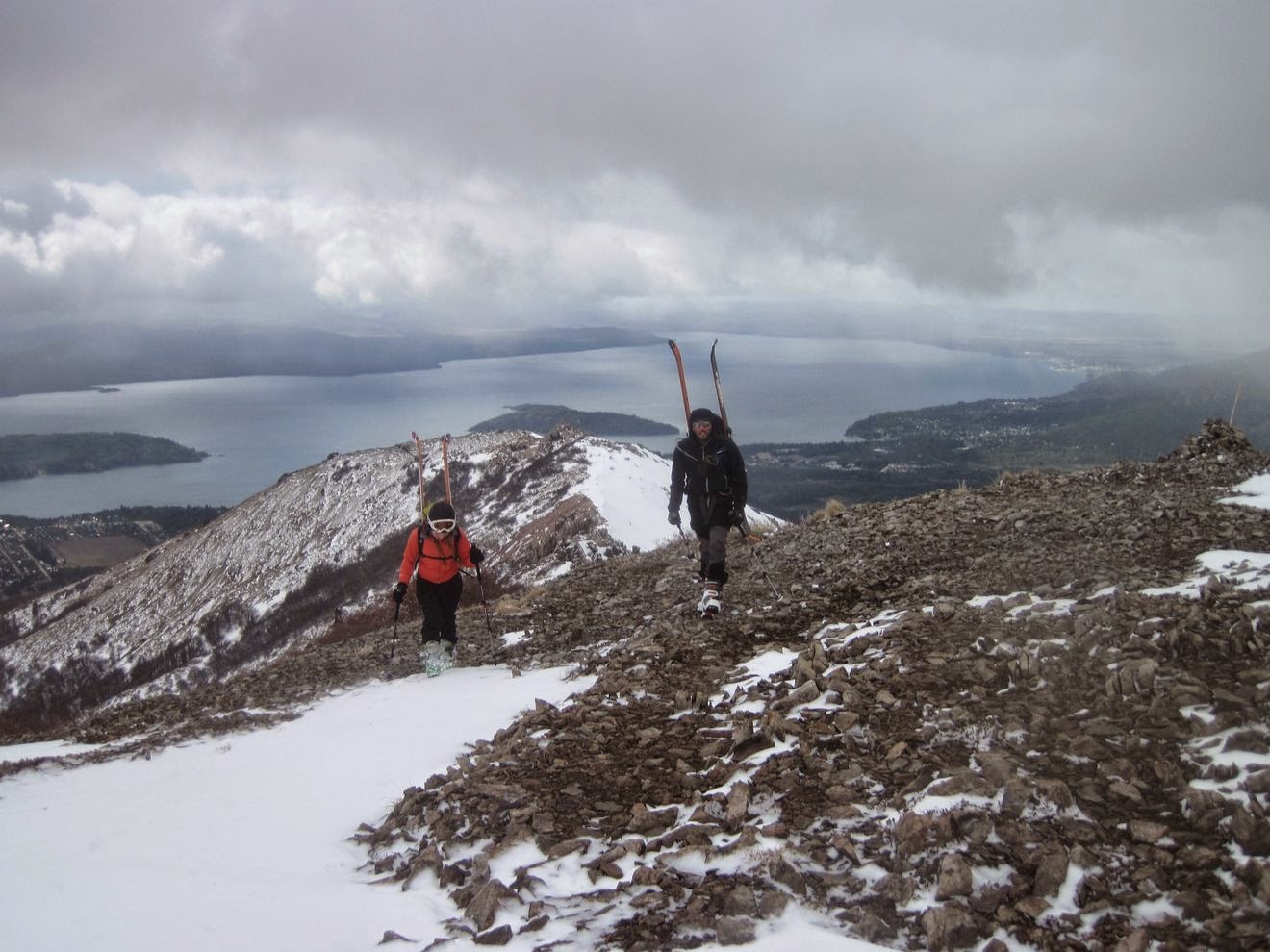
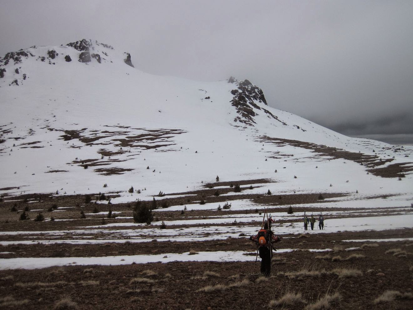
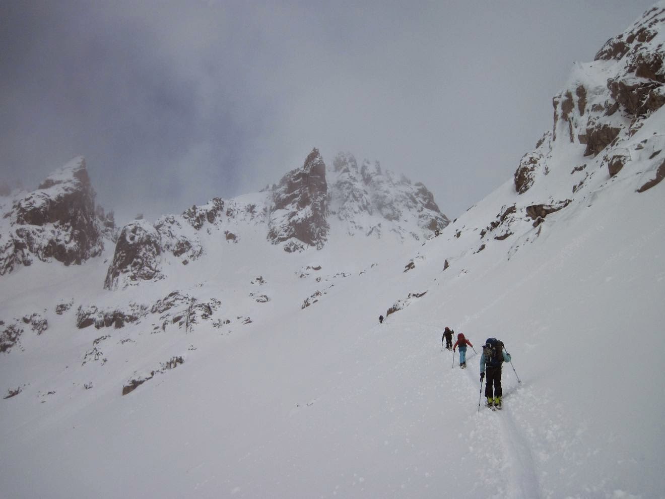
| 19 de julio: Caminando por el bosque del cerro Goye, con Ana y el Pájaro. La idea era esquiar la cara sudeste del cerro Bella Vista, que está cerca del cerro Goye. La semana anterior había nevado mucho, y para el fin de semana la temperatura estaba subiendo. Dos días antes, un esquiador había iniciado una avalancha de placa cerca de Catedral (no hubo heridos) en una pendiente de unos 35 grados. Considerando todo esto, decidimos ir a mirar la pendiente en cuestión desde el oeste, donde el manto de nieve era bastante más fino y las pendientes, más suaves. (Foto por el Pájaro) July 19th: Venturing into the forest of Goye hill, with Ana and El Pájaro. The idea was to go skiing the southeast slope of Bella Vista hill, which is near Goye hill. We had some big storms during that week, and by the weekend the temperatures were going up. Two days before, a skier started an slab avalanche near Catedral hill (no one was hurt) in a south slope of about 35 degrees. Considering this facts, we decided to go looking our target slope from the west, were the snow coverage was shallower and the slopes were more gentle. (Foto by Pájaro) |
 |
| 19 de julio: El Pájaro llegando a la cumbre de un pico cercano al cerro Bella Vista, que se ve en el fondo a la izquierda. Las nubes bajas a la derecha muestran la inversión térmica. Queríamos esquiar las pendientes al este del Bella vista, que se ven a la derecha del filo, con bastante más acumulación de nieve que las caras oeste. July 19th: El Pájaro getting to the top of a secondary peak near Bella Vista hill, which can be seen at left in the foreground. The clouds showing thermal inversion are also visible at the right. We were aiming at the east slopes, which can be seen to the right side of the ridge, with more snow accumulation than the west slopes. |
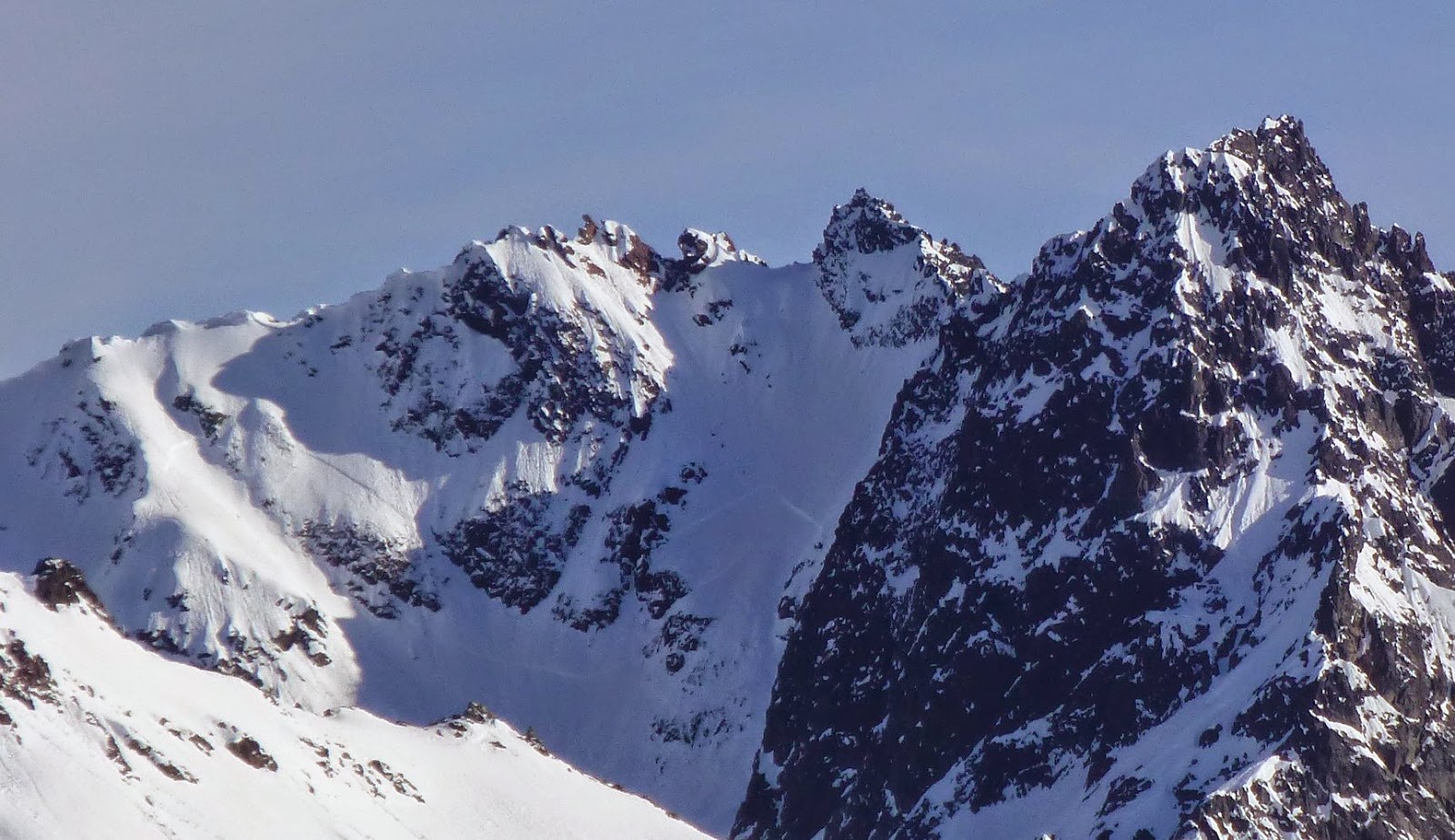 |
| 19 de julio: Una vista con zoom de algunas caras este en el cerro Lopez, el pico a la derecha es el pico Fino. Se ven algunas avalanchas de placa, en pendientes de unos 35 grados. Analizando las condiciones y la reciente actividad de avalanchas, decidimos no esquiar la cara este del Bella Vista ese día. (Foto por el Pájaro) July 19th: A zoomed view of some east slopes of Lopez hill, the peak to the right is Finó Tower. Some slab avalanches can be seen there, the steepness of that slopes is about 35 degrees. Looking at the conditions and recent avalanche activity, we decided not to ski Bella Vista's east slopes that day. (Foto by Pájaro) |
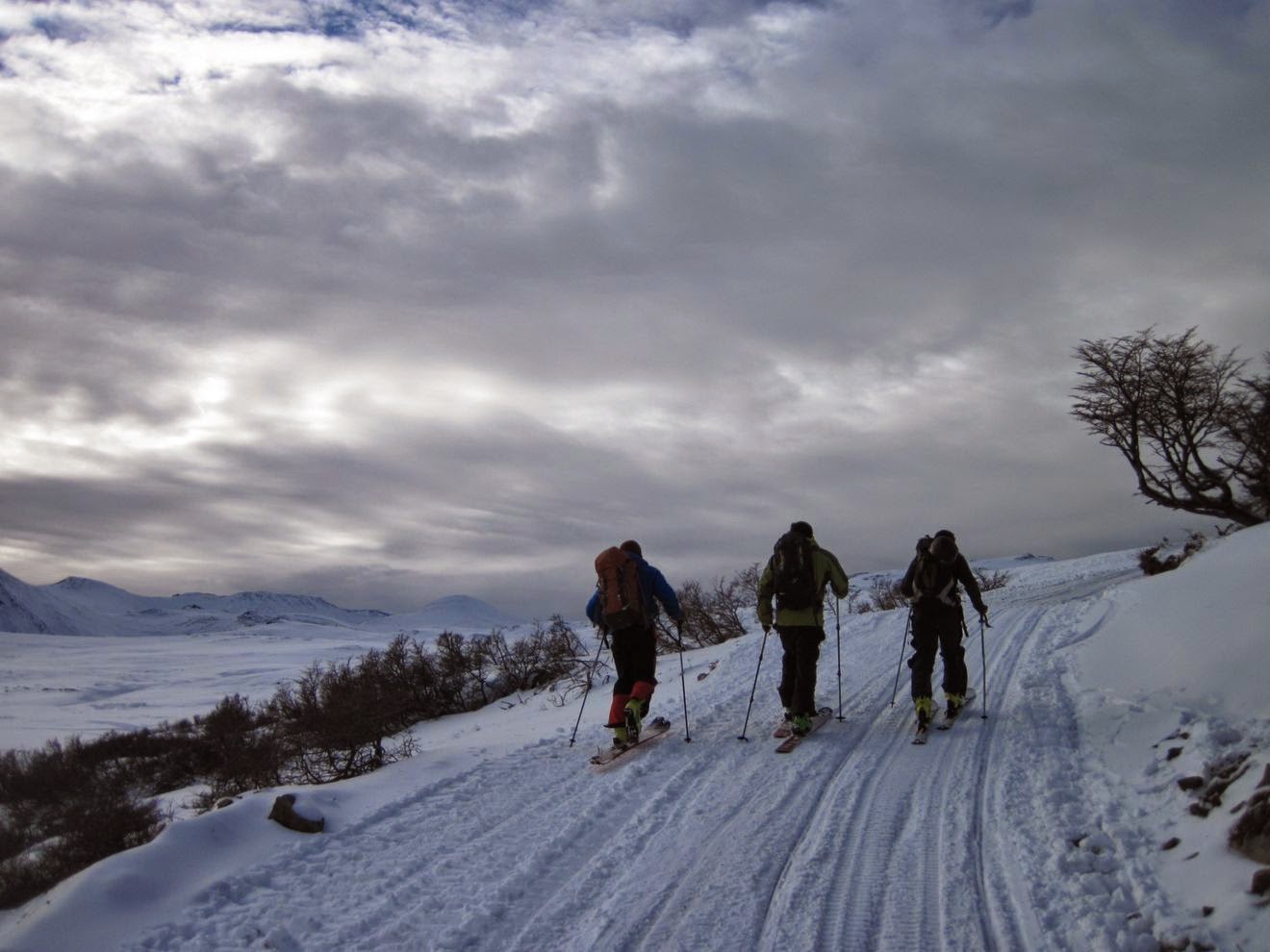 | |
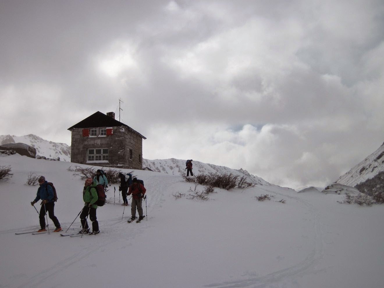
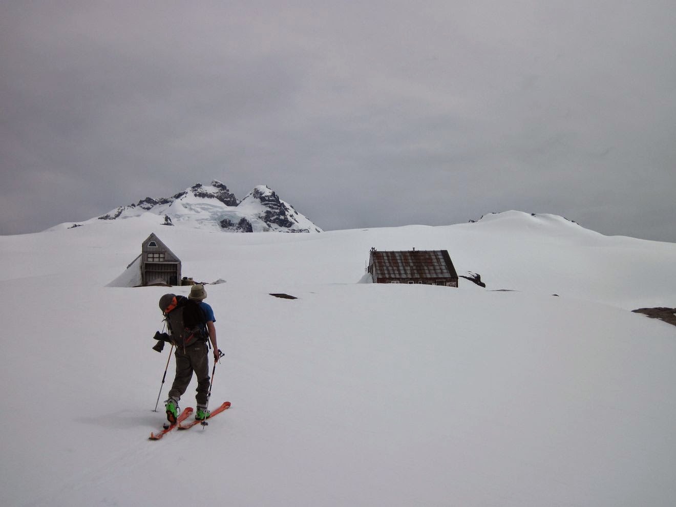
| 26 de julio: Camino al refugio Baguales, durante una salida de esquí de travesía con el Club Andino Bariloche. Pudimos disfrutar de un buen día de esquí, a pesar del pronóstico de viento y lluvia (puede fallar, como esta vez). July 26th: Heading up to Baguales hut, during a Club Andino Bariloche ski tour. We enjoy a great skiing day despite the forecast of wind and rain (it may fail, for good this time). |
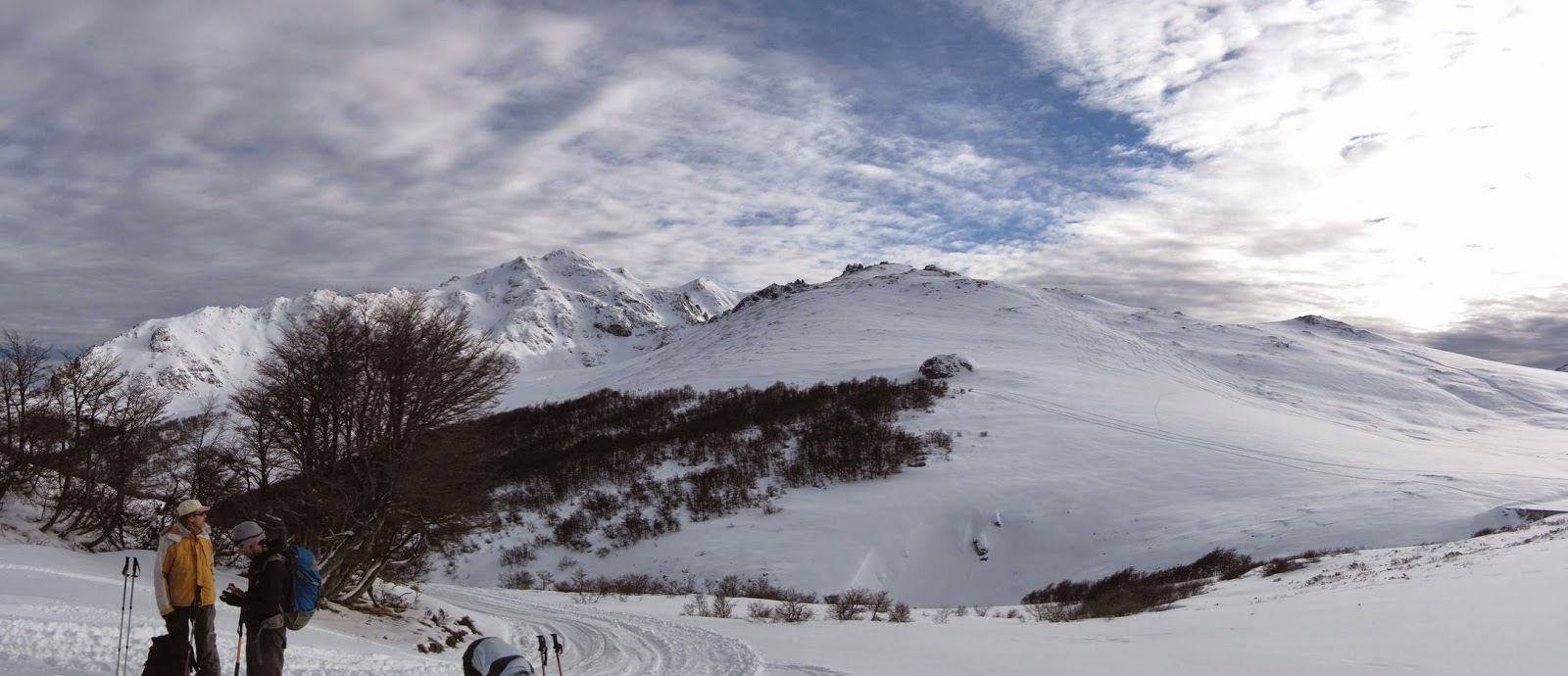 |
| 26 de julio: Mucho terreno para elegir en Baguales, interesante lugar para el esquí de montaña. Nosotros subimos el pico que se ve un poco a la izquierda. July 26th: A lot of terrain options near Baguales hut, interesting place for ski mountaineering. We went up the hill at the bottom, slightly to the left of the picture |
 |
| 26 de julio: Luciano Fiorenza subiendo el filo del cerro Villegas. Empezamos a esquiar un poco más arriba, nos tocó buena nieve para esquiar. La nieve depositada por la tormenta, dos días antes, todavía no se había transformado demasiado. July 26th: Luciano Fiorenza walking up the ridge of Villegas hill. We drop down a little higher and found good snow conditions. The snow of the storm two days before haven't transformed too much yet. |
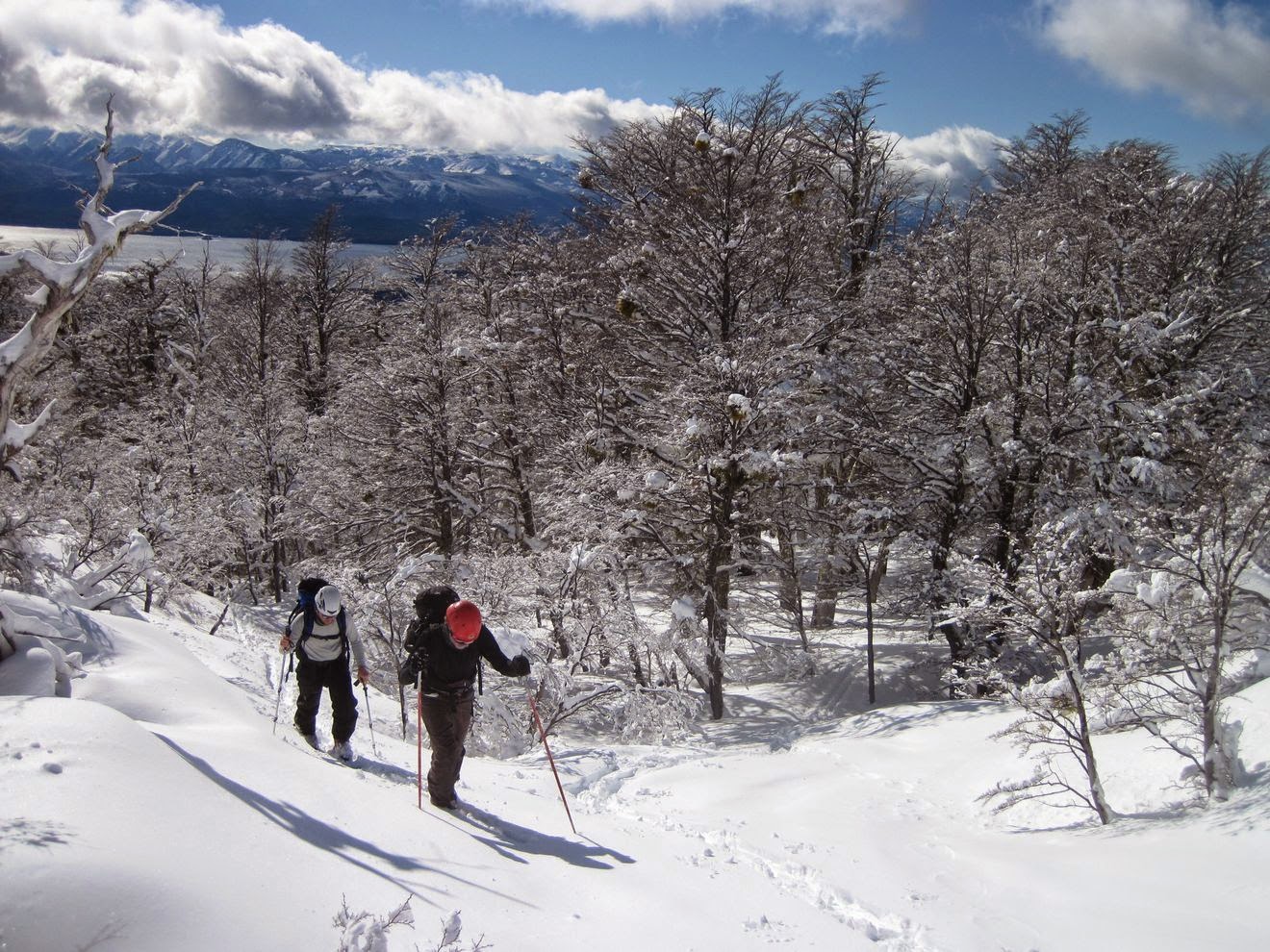 |
| 10 de agosto: Edu y Mati saliendo del bosque en el filo de las Cabras, cerro Lopez. La esquiada por el bosque estuvo muy buena, no tanto en el filo donde había nieve volada. Las caras este estaban cargadas por el viento, así que esquiamos por el filo y adentro del bosque, donde la pendiente es más suave (caras norte y noroeste). August 10th: Edu and Mati getting out the forest in Lopez hill's "filo de las Cabras" (goat's ridge). The skiing through the forest was really good, not so in the ridge where we found some wind affected snow. The east facing slopes where wind loaded, so we skied through the ridge and into the gentle slopes inside the forest (north and north west aspects). |
 |
| 10 de agosto: Apreciando la vista en el filo de las Cabras. El refugio del Lopez se ve de fondo, a la derecha, a mitad de camino de la cumbre (Foto por Matías) August 10th: Appreciating the view at "filo de las Cabras" ridge. Lopez hill hut is visible in the background, to the right, halfway to the top. |
 |
| 10 de agosto: Mati y Edu en la cumbre del filo de las Cabras, las agujas Luhrs y Finó se ven al fondo. Queríamos esquiar el pico Magnat (no se ve en la foto), que está a la izquierda del pico Finó, pero después de evaluar el clima y las condiciones de la nieve decidimos esquiar un par de vueltas por el filo de las cabras. August 10th: Mati and Edu at the top of "filo de las cabras", Luhrs and Finó towers are visible in the back. We were hoping to ski Magnat peak (not visible in the picture), which is left of Finó tower, but based on the weather and snow conditions we decided to make some laps through "filo de las cabras" ridge. |
 |
| 31 de agosto: Ana subiendo el cerro Lopez, arriba del refugio (que se ve a la izquierda). Esta salida fue después de varios días de clima cálido que dio lugar a un ciclo de avalanchas de nieve húmeda. Se puede ver una avalancha un poco a la derecha del refugio, bajando justo por la picada de verano al pico turista. August 31th: Ana skinning up Lopez hill, above the hut (visible at middle left). This was after some hot weather which led to wet avalanches. One can be seen to the right of the refugee, it goes through part of the summer trail. |
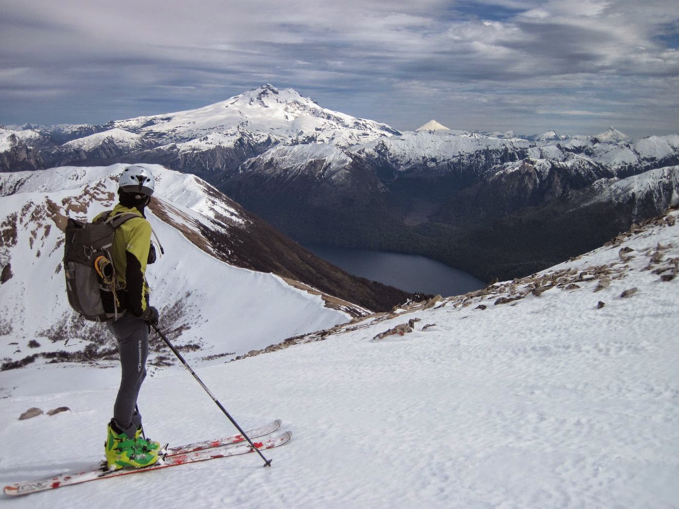 |
| 31 de agosto: Buena vista en el filo del Lopez, el Tronador de fondo, los volcanes Osorno y Puntiagudo a su derecha. La semana anterior tuvimos condiciones de nieve primavera, pero después bajó la temperatura e incluso cayó un poco de nieve (algo de 30 cm en zonas de acumulación). Incluso pudimos esquiar un poco de nieve polvo en las pendientes sudeste donde el sol no había afectado tanto la nieve. (Foto por Ana) August 31th: Good view at Lopez hill ridge, Tronador volcano at the background, Osorno and Puntiagudo volcanos to the right. The previous week we had spring conditions, but then the temperatures went down and even snowed a little bit (about 30 cm in accumulation zones). We even skied some powder snow in south east facing slopes where the sun didn't affected the snow too much. (Photo by Ana) |
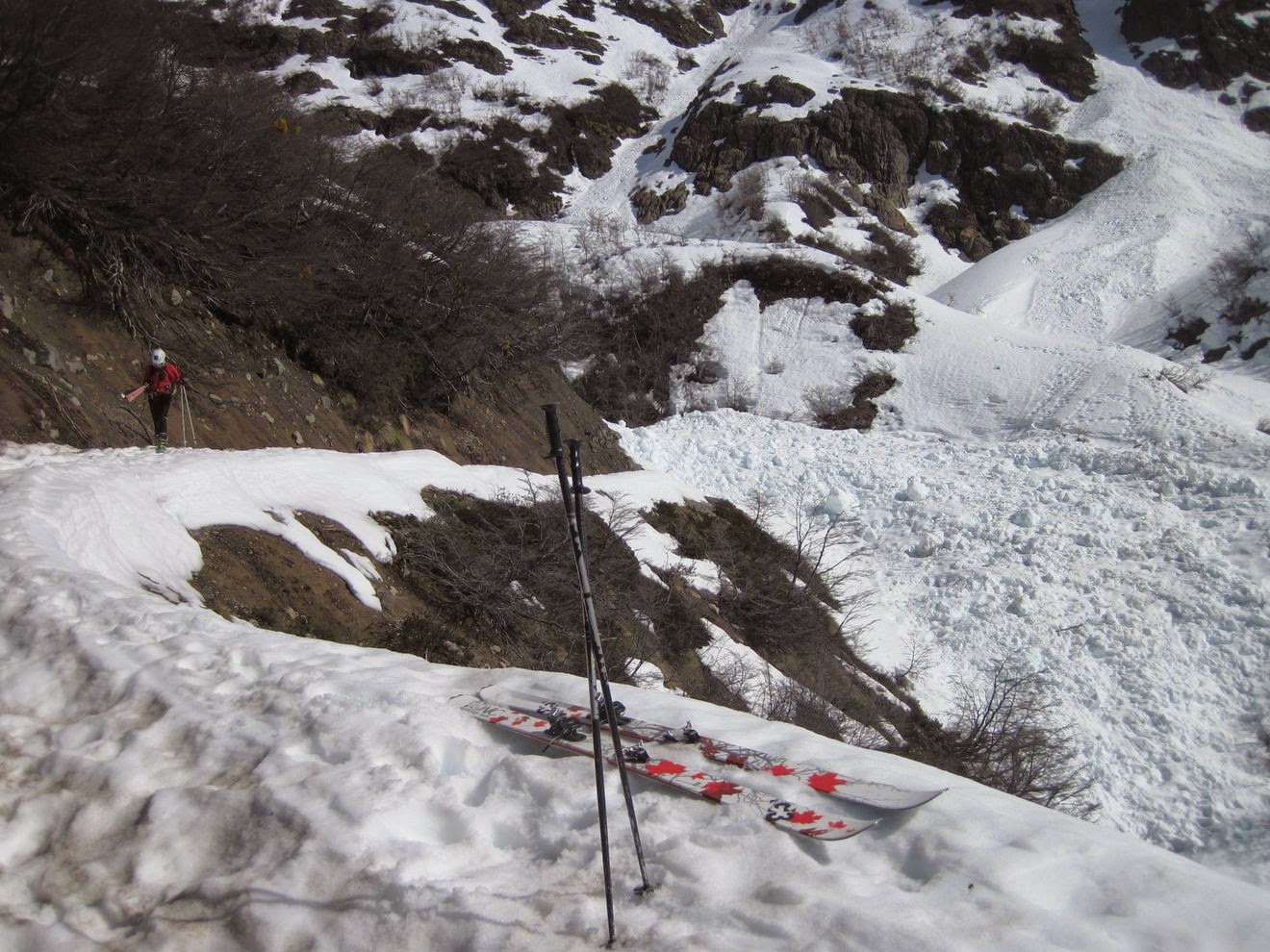 |
| 31 de agosto: Cruzando el depósito de una avalancha de algunas semanas atrás, resultado de varios días de calor. Un guía me dijo que esa cae por lo menos una vez por año. August 31th: Crossing a wet avalanche path from some weeks ago, the result of too much temperature. A guide told me that one comes down at least once a year. |
 | |
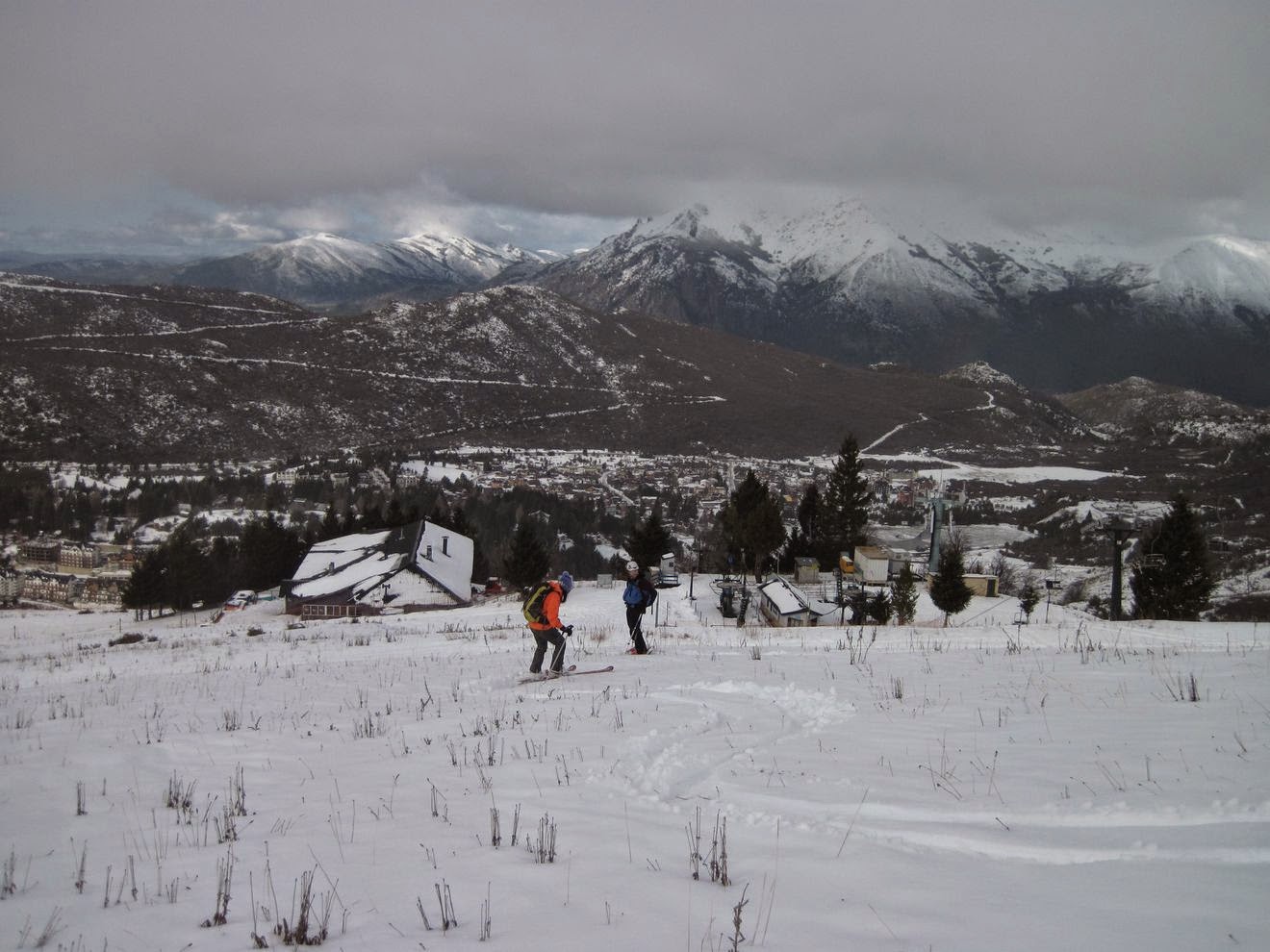
| 6 de septiembre: Preparándonos para bajar, cerca del centro de esquí Catedral, con Martín, Capi, Nati y Seba. La idea era dar una vuelta por el valle del Van Titter, pero el clima estaba un tanto inestable, ventoso y nublado, así que decidimos quedarnos más cerca de las pistas, un lugar más conocido y con más puntos de referencia en caso de poca visibilidad. Se puede ver un medio de elevación a la derecha, que no funciona, y el centro de esquí está atrás del filo de la izquierda. September 6th: Preparing for the down near Catedral ski center, with Martín, Capi, Nati and Seba. The idea was to make some turns in the Van Titter valley, but the weather was a little bit unstable, windy and cloudy for some moments, so we chose to stay near the ski slopes, a more known terrain with some reference points in case of poor visibility. An inoperative ski lift is visible at the right, the ski center is besides the left ridge |
 |
| 6 de septiembre: Poniendo las pieles en la Lagunita después de una buena bajada (foto por Seba) September 6th: Putting skins on at La Lagunita after a good run (photo by Seba) |
 |
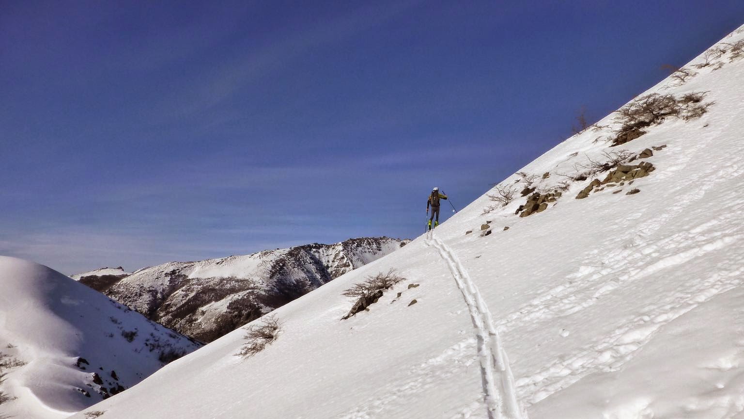
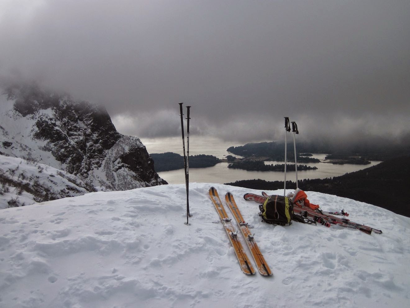
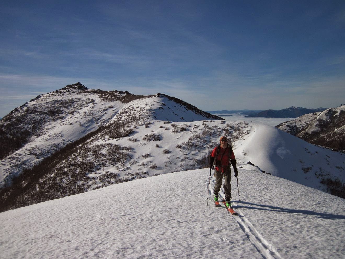
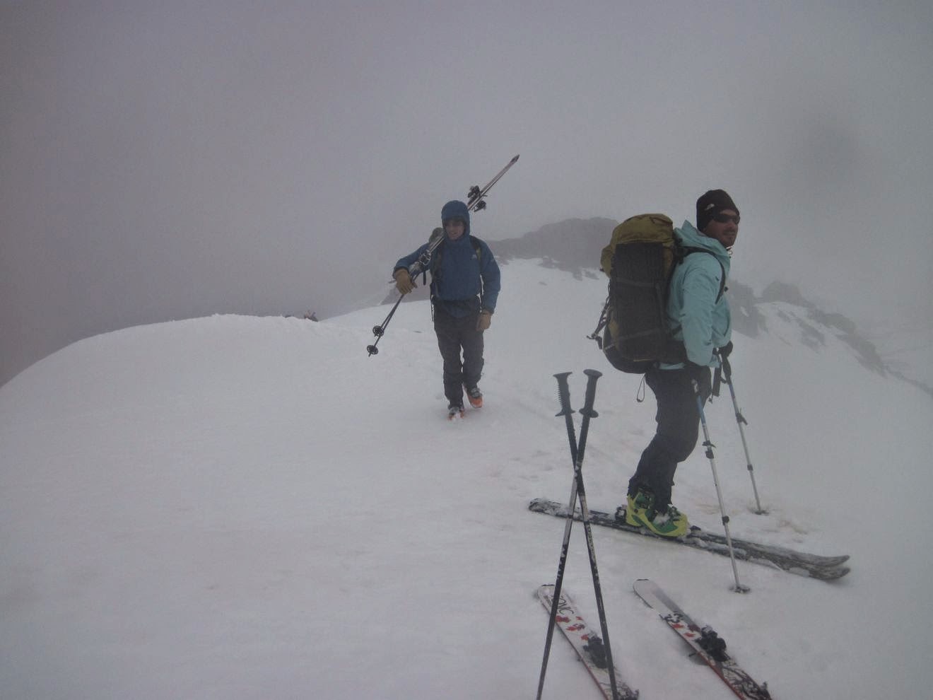
| 7 de septiembre: Martín y Nati caminando por el filo noreste del Bella Vista. Volvimos a ver si podíamos esquiar la cara sudeste, esta vez el riesgo de avalancha era bajo (1). La nieve empezaba un poco arriba, alrededor de los 1500 msnm, y subimos por la picada de verano que sube por el este. September 7th: Martín and Nati walking up Bella Vista northeast ridge. We came back to ski the southeast slopes, this time the avalanche danger was low (1). The snow line was high, about 1500 masl, and we took the summer trail that goes through the east ridge. |
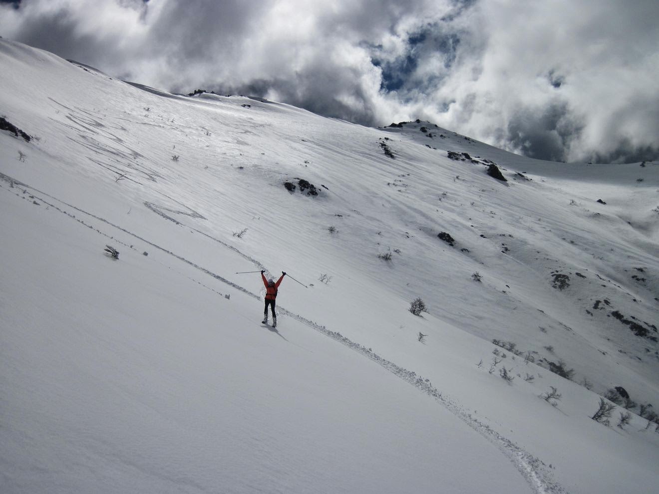 |
| 7 de septiembre: Ana bajando desde la cumbre del Bella Vista, arriba a la derecha. La esquiada valió la pena la caminata. September 7th: Ana coming down from Bella Vista summit, at top right. The skiing worth the walking. |
 |
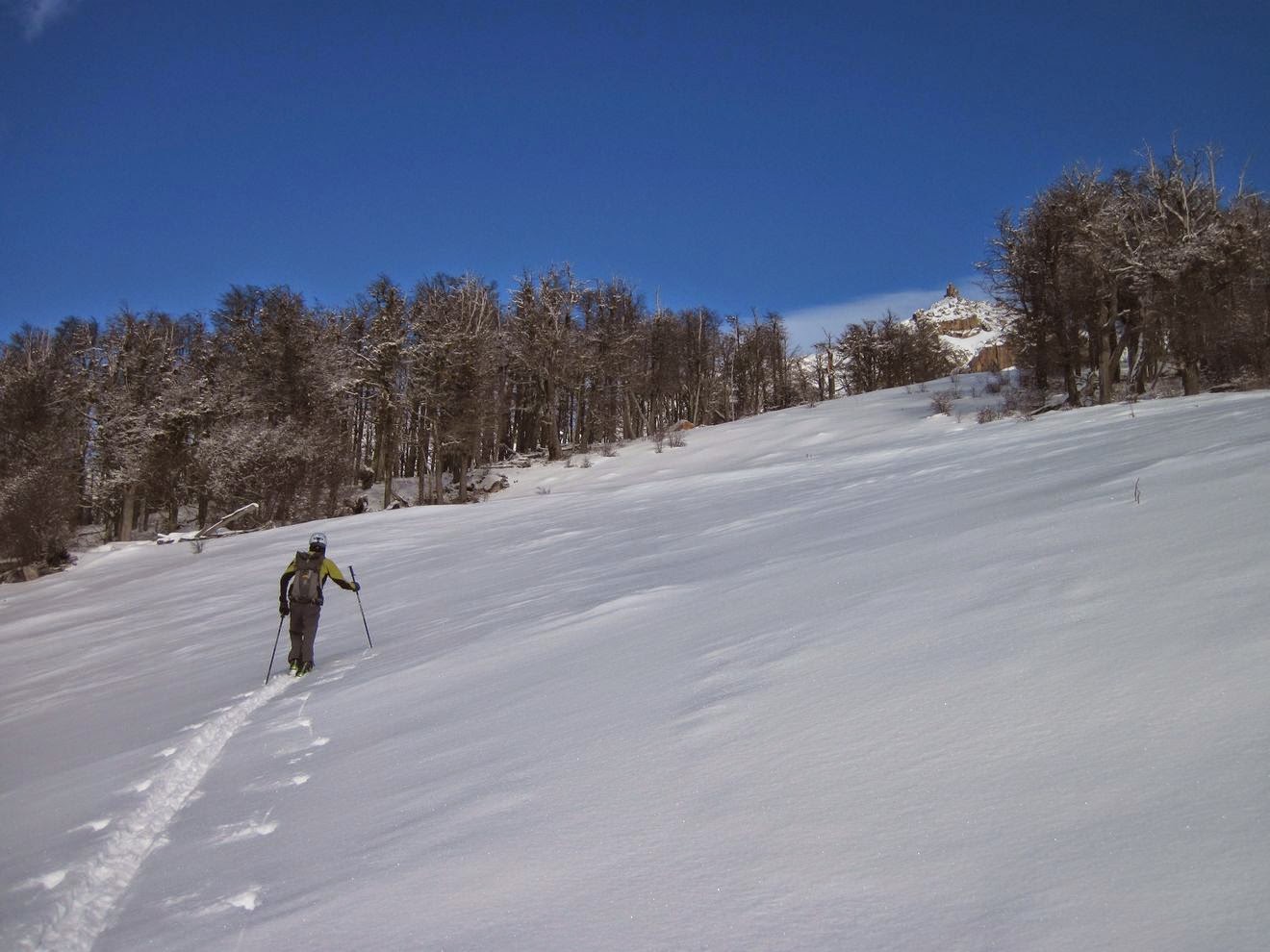
| 13 de septiembre: Esquiando en el valle del Van Titter, cerca del refugio Frey. Diego bajando cerca del filo entre el valle del Van Titter y el valle del Rucaco. September 13th: Skiing in the Van Titter valley, near Frey hut (Catedral). Diego coming down near the ridge between Van Titter and Rucaco valley. |
 |
| 13 de septiembre: Maca esquiando nieve variable, mientras Diego saca algunas fotos. Bajaron cómodamente con sus esquies anchos, a mi me costó un poco más con la nieve variable, esquíes de 75 mm (BD Guru) y una mochila para dos días. September 13th: Maca skiing variable snow conditions, while Diego takes some pictures. They were going down effortless in their fat skis, while I was fighting the variable snow with my 75 mm waist BD Guru and a two day pack. |
 |
| 20 de septiembre: Curso de avalancha en el cerro Piltriquitrón, cerca de El Bolsón. Tiene que haber algo de nieve por ahí... Condiciones de nieve primavera en casi todos lados. September 20th: Avalanche course in Piltriquitrón hill, near El Bolsón. There should be some snow somewhere... Spring conditions almost everywhere. |
 |
| 20 de septiembre: Diego y Fede llegando al filo, hora de volver al refugio después de un día de hacer pozos de nieve, estudiando el manto y el clima. September 20th: Diego and Fede getting to the ridge, time to go back to the hut after a day of snow pits, test and observations. |
 |
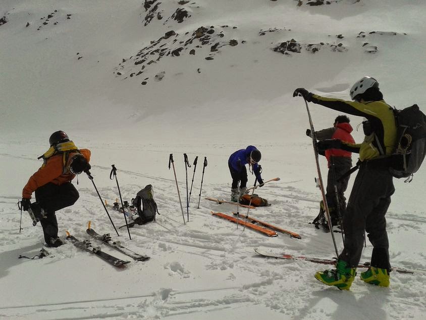
| 27 de septiembre: Otro fin de semana de curso de avalancha, esta vez en el refugio Frey, Catedral, cerca de Bariloche. Practicando búsqueda y rescate con dos víctimas. Ese fin de semana nos tocó un poco de nieve fresca, para hacerlo más interesante. September 27th: Another weekend of avalanche training, this time in Frey hut, Catedral, near Bariloche. Practicing multiple burial rescue. This weekend we had some fresh snow to play with. |
 |
| 28 de septiembre: Arrancando la salida de esquí de travesía, desde el refugio Frey hasta el centro de esquí de Catedral. September 28th: Starting the tour out of Frey hut, towards Cerro Catedral ski resort. |
 |
| 28 de septiembre: El grupo acercándose a la laguna Schmoll, esta era la sección más empinada del día. Se veían algunas pequeñas avalanchas puntales en las pendientes más empinadas. September 28th: The group approaching Schmoll lagoon, this was the steepest section of the day. Some small point release avalanches were seen in steep slopes. |
 |
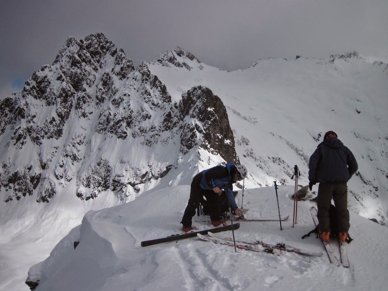
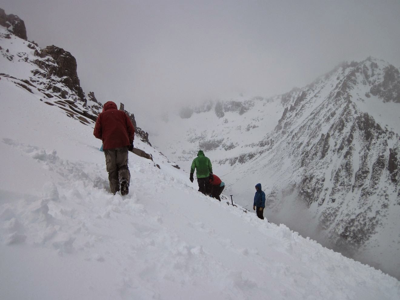
| 28 de septiembre: Ya casi estamos, Fede y Ella caminando por el filo hacia el Catedral. Había mucha acumulación de nieve en las caras este, con pendientes cerca de 35 grados, así que decidimos caminar por la cara oeste. September 28th: Almost there, Fede and Ella walking through the ridge towards Cerro Catedral. There was too much snow accumulation in the east faces, with slopes near 35 degree steep, so we decided to walk through the west face. |
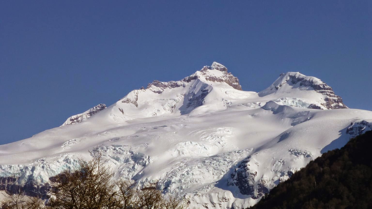 | |
| 4 de octubre: Cerro Tronador, visto desde el camino a Pampa Linda. La cumbre (límite entre Argentina y Chile) en el centro, el pico argentino a la derecha, el picho chileno está oculto por la cumbre principal. (Foto por el Pájaro) October 4th: Tronador volcano, seen through the road to Pampa Linda. The summit (limit between Argentina and Chile) is in the middle, the argentinian peak to the right, the chilenian peak is hidden by the main summit. (Foto by Pájaro) |
 |
| 4 de octubre: El Pájaro llegando al refugio Otto Meiling. La idea era subir al refugio el primer día e intentar la cumbre al día siguiente, volviendo a Bariloche ese mismo día. October 4th: El Pájaro approaching Otto Meiling hut. The idea was to get to the hut the first day, and try to get to the summit and back to Bariloche the second day. |
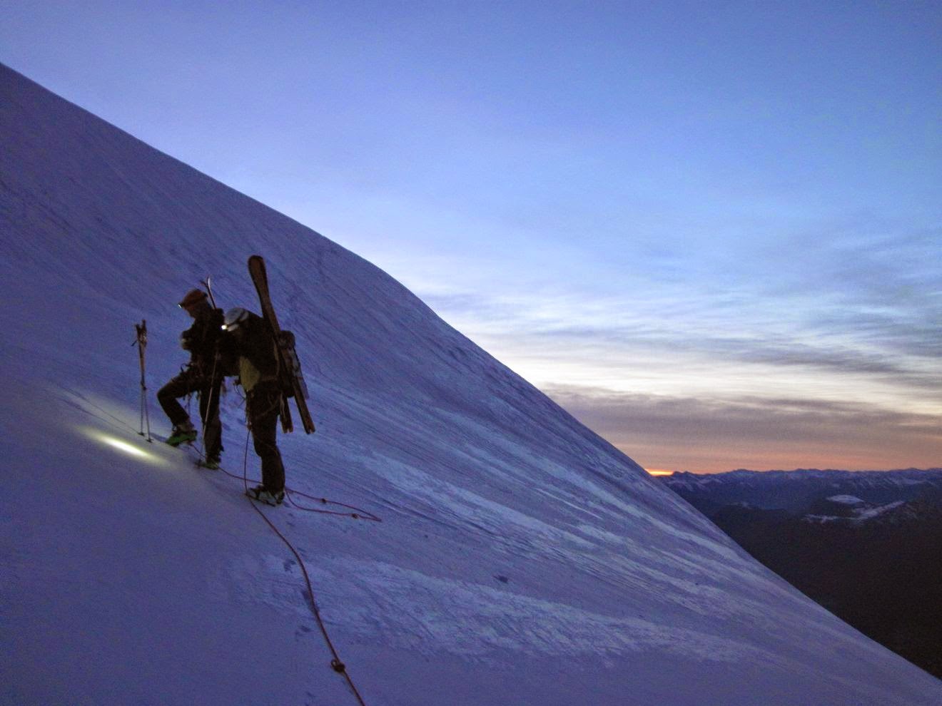 |
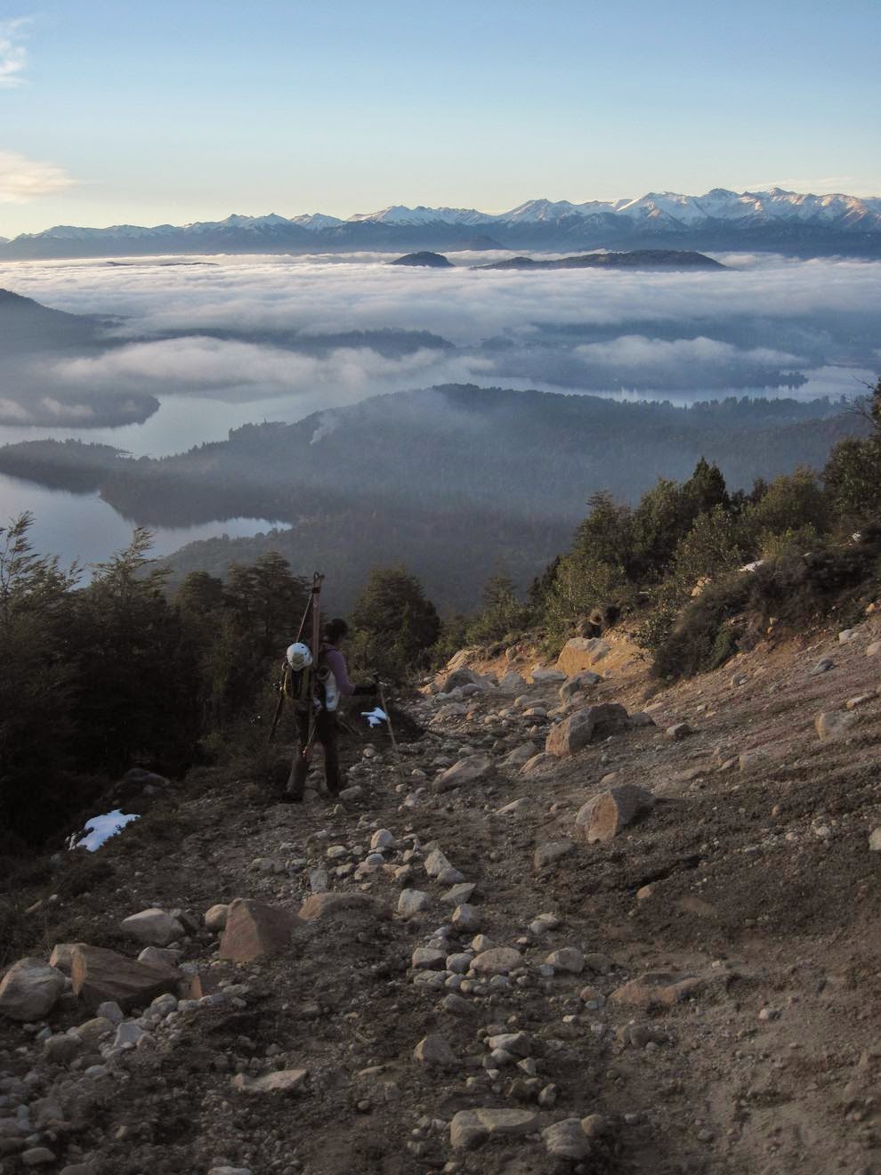
| 5 de octubre: El amanecer nos agarró bajando del filo de la Vieja, después de tres horas y media de foquear y caminar. October 5th: Dawn got as walking down "La Vieja" ridge, after about three and a half hours of skinning and walking. |
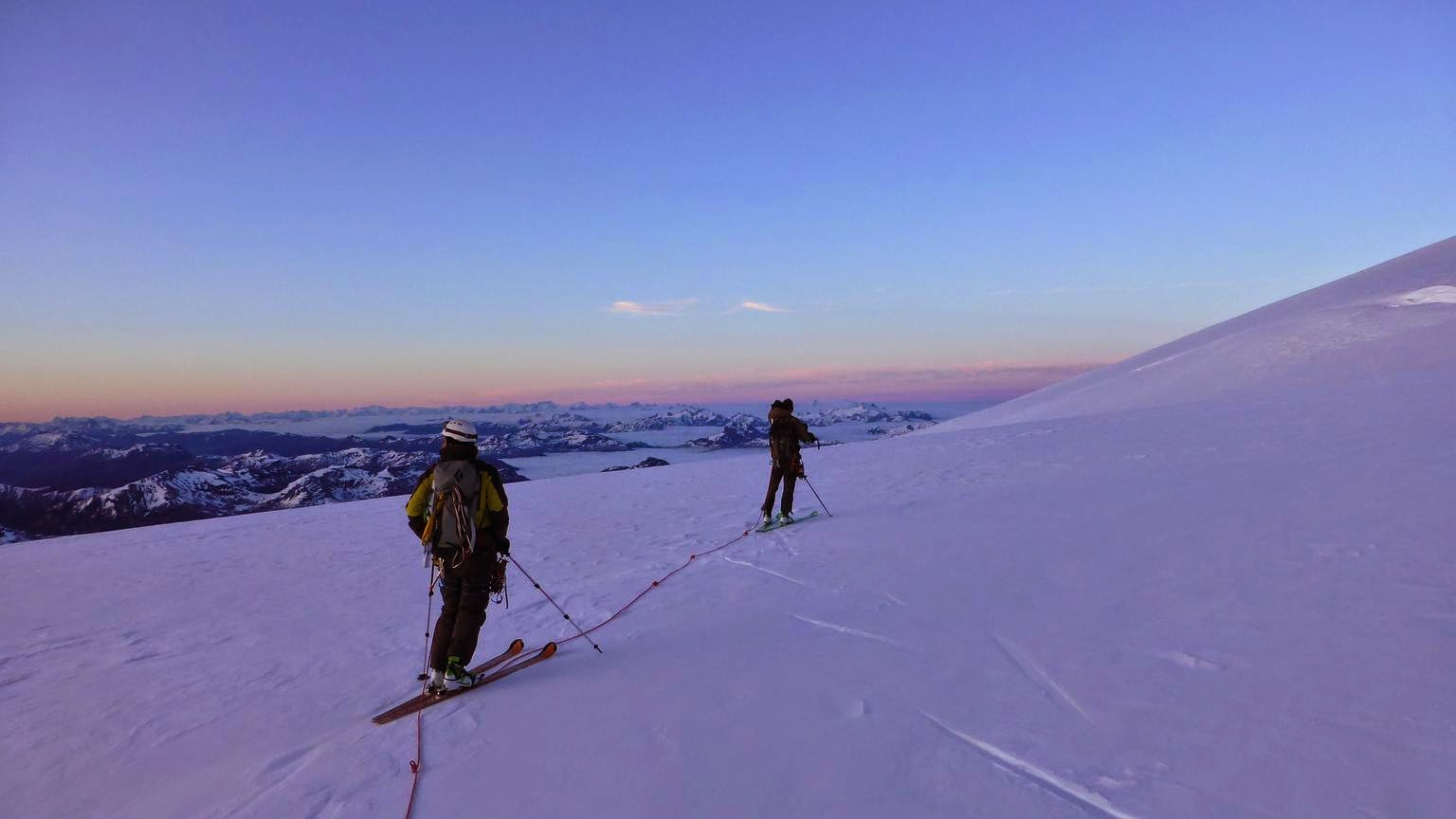 |
| 5 de octubre: Cruzando el glaciar Manso, hacia el glaciar Blanco. Seguíamos la ruta Meiling - Vallmitjana, que hace una especie de espiral hacia la cumbre, empezando por el este, después girando al sur, luego al oeste, para finalmente alcanzar la cumbre por la cara norte. (Foto por el Pájaro) October 5th: Crossing El Manso glacier, towards Blanco glacier. We were following the Meiling - Vallmitjana route, that takes a kind of spiral to the summit, starting from the east, then going south, after that to the west and finally approaching the summit through the north. (Foto by Pájaro) |
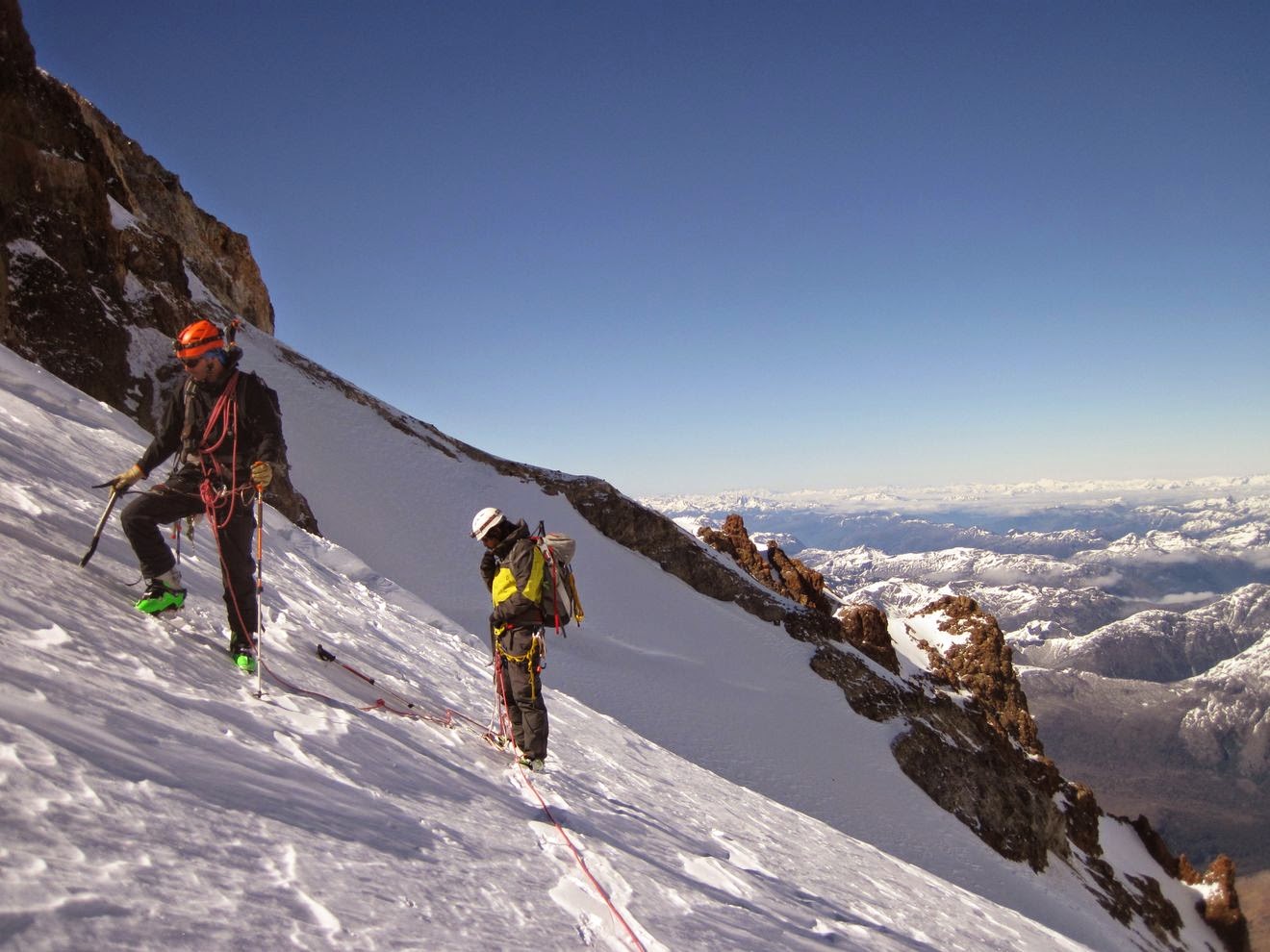 |
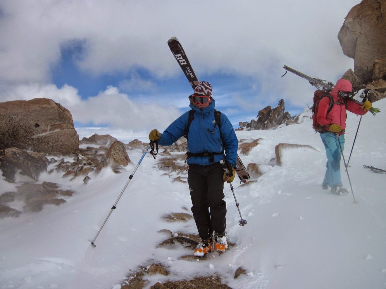
| 5 de octubre: Caminando por el glaciar Blanco, dejamos los esquíes en el filo entre los glaciares Blanco y Manso. Después de ese punto, las pendientes se volvían más empinadas y la nieve estaba buena para caminar, así que decidimos dejar un poco de peso con la esperanza de movernos más rápido. October 5th: Walking through Blanco glacier, we left the skis at the ridge between Blanco and Manso glaciers. After that point, the slopes get steeper and the snow was good to walk through, so we decided to leave some weight hoping for a faster pace. |
 |
| 5 de octubre: Cruzando el glaciar Blanco, en el centro de la foto se aprecia la cara sur del pico internacional. October 5th: Crossing Blanco glacier, international peak south face can be seen at the center of the picture. |
 |
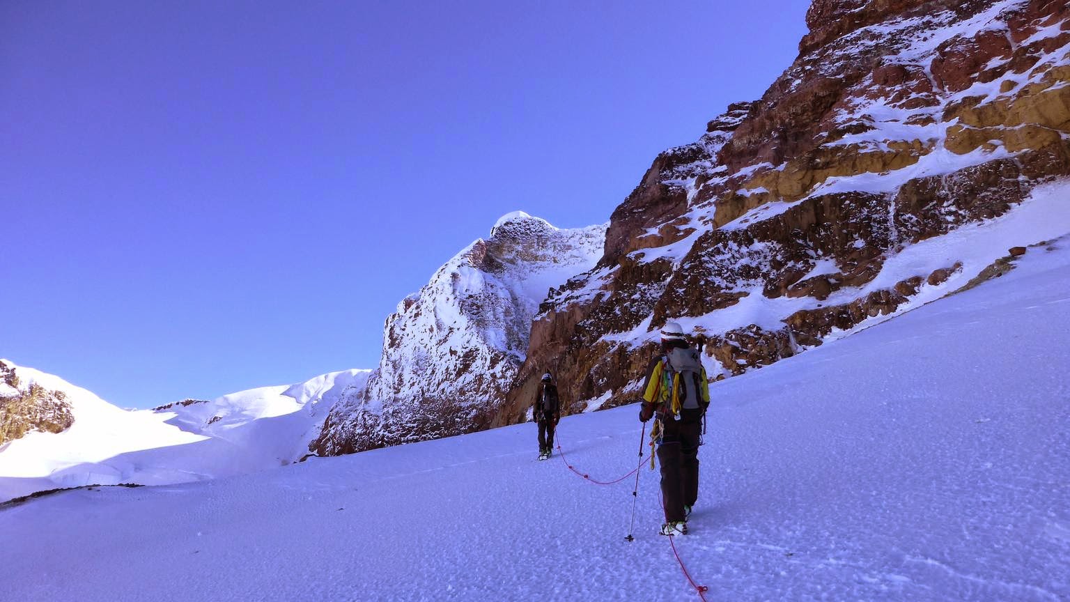
| 5 de octubre: Manque y el Pájaro llegando al filo entre los glaciares Blanco y Casa Pangue. October 5th: Manque and Pájaro getting on the ridge between Blanco and Casa Pangue glaciers. |
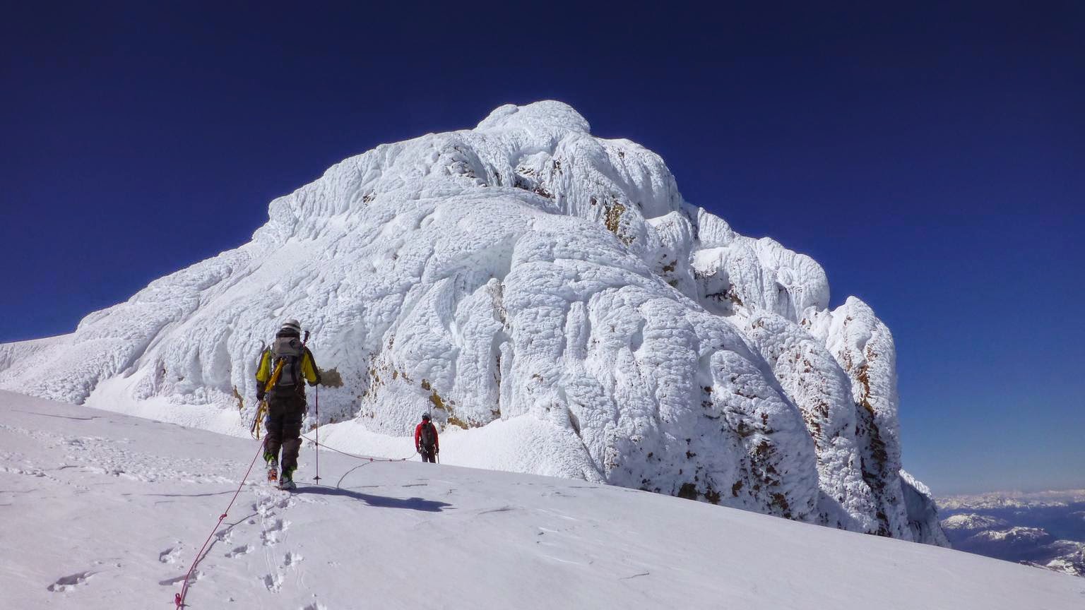 |
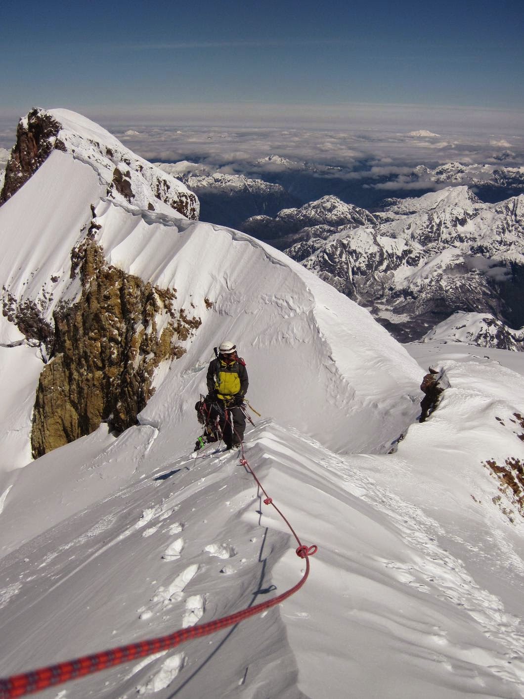
| 5 de octubre: Manque y yo acercándonos a la cumbre, la ruta hace una travesía a la izquierda y después sube una rampa de nieve en la cara norte, de unos 45 grados de pendiente máxima. (Foto por el Pájaro) October 5th: Manque and me approaching the summit, the route traverse to the left and then climbs up the north face through a snow field about 45 degrees steep. (Foto by Pájaro) |
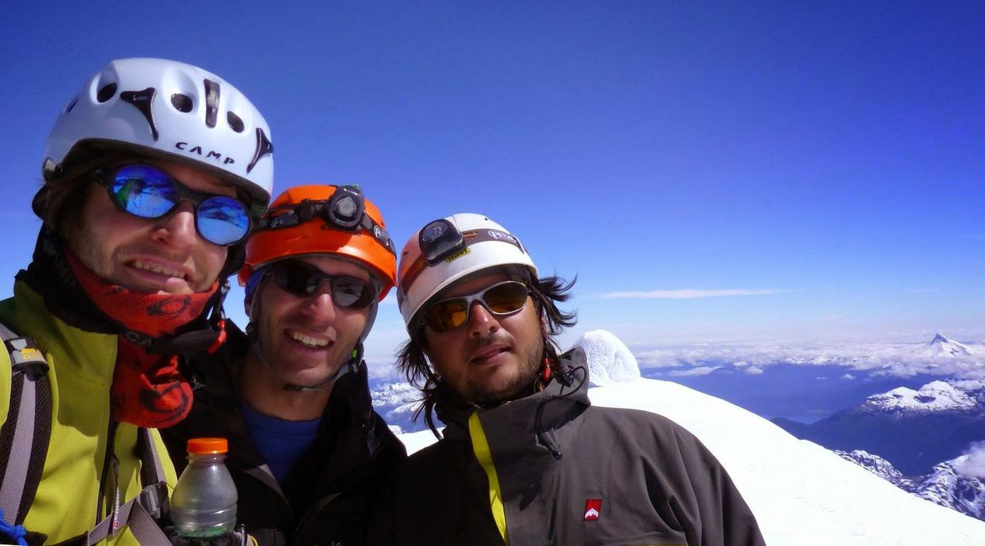 |
| 5 de octubre: El equipo en la cubre, yo, el Pájaro y Manque (de izquierda a derecha). Al fondo se ve el hongo de la cumbre, ¿cuál es más alto? Estuvimos de acuerdo en que era un empate técnico... October 5th: The team at the summit, me, Pájaro and Manque (from left to right). The summit mushroom can be seen at the bottom, which one is higher? We agree it was a technical draw... |
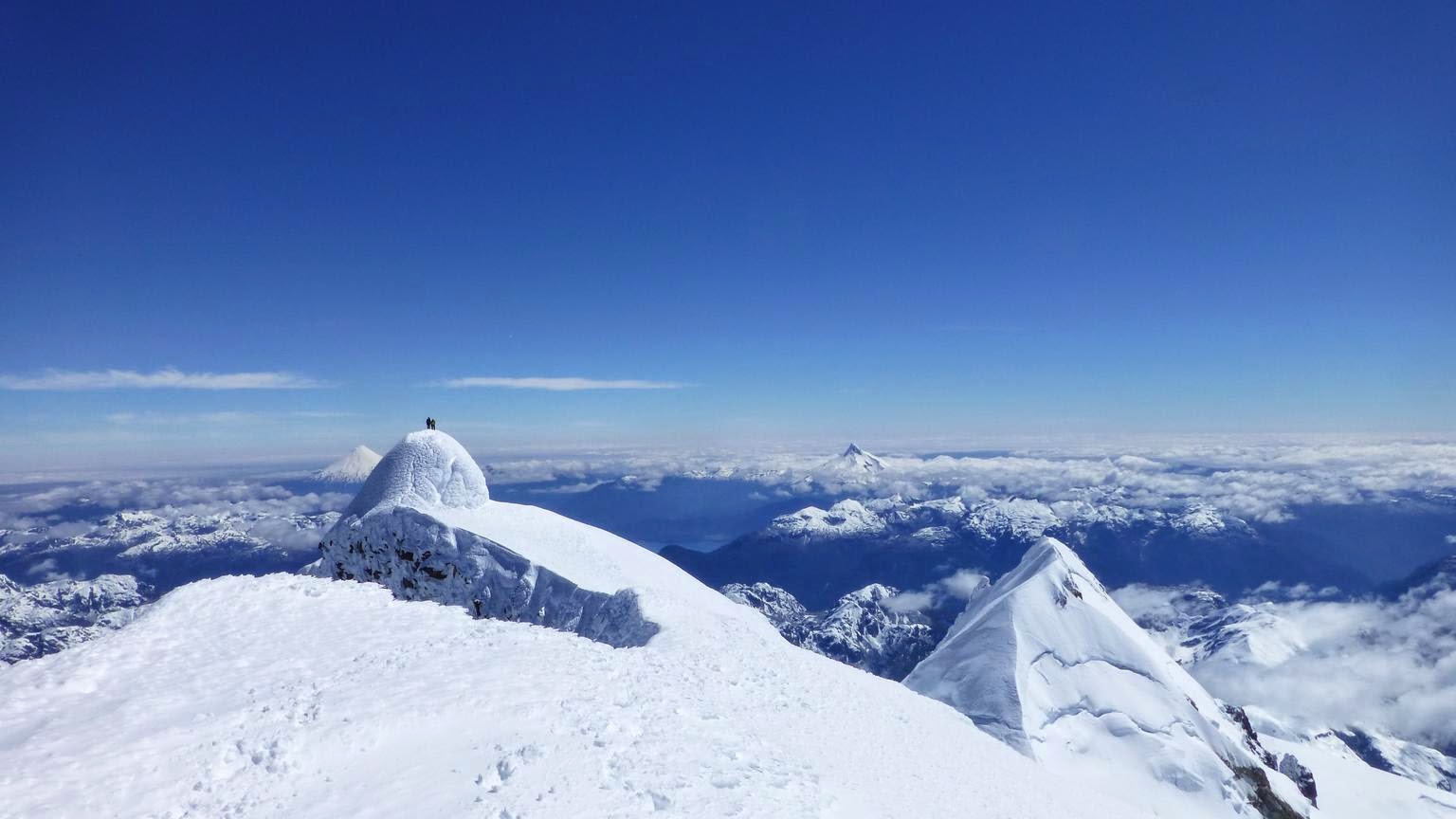 |
| 5 de octubre: El Pájaro y Manque en el hongo de la cumbre, el pico chileno a la derecha, el volcán Osorno se ve a la izquierda de la cumbre, y el volcán Puntiagudo a la derecha, entre la cumbre y el pico chileno. October 5th: Pájaro and Manque in the mushroom, the chilenian peak to the right, Osorno volcano is visible to the left of the summit, and Puntiagudo volcano, between the summit and the chilenian peak. |
 |
| 5 de octubre: De vuelta en el refugio, después de 14 hs en movimiento. A no relajarse mucho, que todavía hay que volver al auto. (Foto por el Pájaro) October 5th: Back at the hut, after 14 hs on the move. Don't relax to much, we still have to get to the car. (Foto by Pájaro) |
Hola Agustín! Muy buena la información de esta publicación, sigue muy vigente al 2021. Me gustaría poder contactarte para hacerte algunas preguntas sobre la ruta al pico internacional del trona!
ResponderBorrar